+7 (812) 645-08-06
Geographical information systems
select brand


Mobile GIS data collection software - Leica Zeno Field & Office
The Leica Zeno Field and Office software is extremely easy to use in just about any types of applications and projects, being able to respond to emergencies...
Mobile GIS data collection software - Leica Zeno Field & Office
The Leica Zeno Field and Office software is extremely easy to use in just about any types of applications and projects, being able to respond to emergencies and incidents. The manufacturer has also included a set of tools to satisfy the requirements of any application that requires high accuracy and makes use of a GIS database.
Next, the GNSS post-processing process is a fully automated one, while the GNSS technologies seamlessly combine into a simple and intuitive solution. Next, the automated workflow between the office and field and the long term quality are other important aspects to take into account.
Next, the GNSS post-processing process is a fully automated one, while the GNSS technologies seamlessly combine into a simple and intuitive solution. Next, the automated workflow between the office and field and the long term quality are other important aspects to take into account.

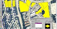
SIG analysis software / cartography - Bentley Map
The Bently Map is a 3D GIS mapping software-based program that addresses the need and challenges of an organization that requires planing, mapping, building, designing and operating infrastructures. The Multiple...
SIG analysis software / cartography - Bentley Map
The Bently Map is a 3D GIS mapping software-based program that addresses the need and challenges of an organization that requires planing, mapping, building, designing and operating infrastructures. The Multiple data types plus fluctuating coordinate systems that are altered while in motion are integrated into the Bently Map.
The Bentley Map provides direct editing for the Oracle Spatial Databases plus total maintenance of topology. The enhanced MicroStation provides powerful precision handling in maintenance, analysis and geo-spatial data creation. Users will be able to easily integrate data from multiple sources into mapping and engineering workflows.
Along with the wide array of applications with this program, it can also publish i-models for map mobiles, and analyze data with 2D and 3D formats.
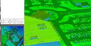
Cartography software / SIG analysis - Bentley PowerMap
Bentley PowerMap can be a top details decision and access assist app for geospatial remedies, supplying technicians by having an simple-to-use, two dimensional gentle-enhancing surroundings....
Cartography software / SIG analysis - Bentley PowerMap
Bentley PowerMap can be a top details decision and access assist app for geospatial remedies, supplying technicians by having an simple-to-use, two dimensional gentle-enhancing surroundings. Coordintaing with geospatial tasks created on MicroStation and MicroStation GeoGraphics, it really is remarkably custom with resources for ui changes and programs growth.
Bentley PowerMap works with the simultaneous looking at (3D and 2D details) and plotting of vector and raster information. With study/publish usage of ODBC-hooked up directories, you more increase your mapping setting. Also you can request Oracle Spatial details to assist the application of organization information inside your mapping workflows.
Bentley PowerMap works with the simultaneous looking at (3D and 2D details) and plotting of vector and raster information. With study/publish usage of ODBC-hooked up directories, you more increase your mapping setting. Also you can request Oracle Spatial details to assist the application of organization information inside your mapping workflows.
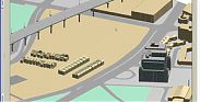
Geographical data management software - ENVI LiDAR
ENVI LiDAR is definitely an entertaining geospatial application atmosphere that allows you to generate practical 3 dimensional visualizations...
Geographical data management software - ENVI LiDAR
ENVI LiDAR is definitely an entertaining geospatial application atmosphere that allows you to generate practical 3 dimensional visualizations and simply remove essential products and features from unprocessed LiDAR stage cloud info. The height information and facts covered inside LiDAR may be used to generate Electronic digital Height Types (DEMs), or perhaps be a part of your geospatial models like range-of-eyesight or proper-of way analyses. ENVI LiDAR may also be tailored using the API to fulfill the distinctive demands of your respective business.