+7 (812) 645-08-06
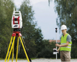
Construction equipment positioning system - Leica RedLine
 The Leica RedLine is used in different applications in construction positioning and layout. It is equipped with GNSS rover solutions for built surveys and set-out operations, GNSS foreman car control as well as GNSS and tracker machine control to accommodate a wider scope of equipment.
 It also has a base station set-up for the utilization in network corrections, command in the establishment as well as design and data control. Moreover, it has station surveys that has set-out and built surveys with one man and two man functions.
The machine is centrally maintained by the user interface of the operator.